Active LOOKNorth Projects
BVLOS/UTM Trial with Edmonton Airport
BVLOS/UTM Trial with Edmonton Airport
The project is collecting in situ performance data to satisfy requirements of respective regulators regarding BVLOS in Canada and the USA by demonstrating the capabilities of Unmanned Traffic Management (UTM) services. The scope of the project focuses on flying BVLOS in a dense urban setting, including around buildings and structures, as well as in the presence of other remotely piloted aircraft.
Mitigating Oil and Gas Methane Emissions in Central Asia with GHGSat
Mitigating Oil and Gas Methane Emissions in Central Asia with GHGSat
In this project, GHGSat is monitoring methane emissions from oil and gas facilities in selected areas in Central Asia with GHGSat’s current satellite (GHGSat-D), as well as the next two satellites (GHGSat-C1 and C2) as they come into service.
GHGSat is adapting analytics developed for North American oil and gas operations to apply to Central Asia. These analytics include greenhouse gas hotspot detection using ESA’s Sentinel5P TROPOMI instrument. GHGSat is working with local operators and regulators to ultimately mitigate the emissions.

Memorial University’s Sustainable Northern Coastal Communities Network Pilot Project
Memorial University's Sustainable Northern Coastal Communities Network Pilot Project
Memorial University’s Office of Public Engagement leads the Sustainable Northern Coastal Communities (SNCC) initiative. Part of Memorial’s COASTS (Cold Ocean and Arctic Science and Technology) initiative, SNCC’s mandate is building upon research and engagement capacity in Northern and remote regions in partnership with Government and research organizations, as well as the communities themselves. The SNCC addresses daunting challenges facing Northern coastal regions by connecting university research capacity, community knowledge and public and private partners.
Creating an Umbrella Organization to Provide Professional UAV/GIS Services throughout the Western Arctic
Creating an Umbrella Organization to Provide Professional UAV/GIS Services throughout the Western Arctic
This project’s objective is:
Training, mentoring and facilitating the certification of UAV Pilots from partner communities in the following areas; advanced mission planning and control, analysis of UAV data and pre-requisites for pilot certification under Transport Canada regulations;
Providing training and on the job mentoring to Remote Sensing (RS) / Geographic Information System (GIS) analyst trainees in image processing, interpretation and extraction;
Identifying and providing support for certified UAV pilots who are interested in starting their own enterprise within the IGUTCHAQ UAV umbrella organization. A minimum of 5 enterprises are planned.
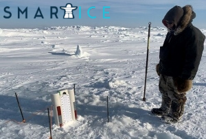
Advancing operations with the award-winning SmartICE application
Furthering our work with the award-winning SmartICE application
SmartICE is an award-winning technological innovation for the North…integrat(ing) traditional knowledge of sea ice with advanced data acquisition and remote monitoring technology. (Their) system combines these approaches to provide invaluable, data-driven insights into sea-ice thickness and local ice conditions, in near real-time (smartice.org). We are working together to advance their organization and further SmartICE’s commercialization, while overcoming barriers to sustainable industry in the North and focusing on opportunities for local employment & training to create a sustainable, skilled workforce.
Cellular-enabled RPAS Traffic Management (RTM) with AirMarket
Cellular-enabled RPAS Traffic Management (RTM) with AirMarket
Over the span of several years, this project will validate the concept for cellular-enabled RPAS Traffic Management (RTM) and allow for safe BVLOS operations. AirMArket and TELUS strive to provide a holistic approach for the integration of airspace for both manned and unmanned aircraft.
Their solution will leverage both terrestrial and satellite based 4G/LTE connectivity services for the identification and tracking of drones, while ensuring effective Detect and Avoid capability. It will also provide the technological framework that will encourage the use of BVLOS technologies in many other industries including rail, mining, infrastructure, and construction.
RPAS Traffic Management (RTM) Enabler with Peraton Canada
RPAS Traffic Management (RTM) Enabler with Peraton Canada
With this project, Peraton Canada strives to validate RPAS Traffic Management (RTM) to allow for routine BVLOS operations. Flight testing will be conducted to trial RTM services and technology and generate data to assist with the development of BVLOS flight.
The testing performance data will be delivered to Transport Canada/NAV Canada to increase the safety and efficiency of RPAS technology. The services that will be tested are remote ID, flight preparation and planning, geo-fencing, situational awareness, and flight and conflict management.
The project will also carry out four flight operations under RTM which include pipeline inspection, obstacle limitation surfaces (OLS) detection, foreign object debris (FOD) detection, and runway marking analysis (RMA).

Development of a Northern Canadian Geospatial Innovation Centre (NCGIC) with DNA
Development of a Northern Canadian Geospatial Innovation Centre (NCGIC) with DNA
In Inuvik, Delta Northern Alliance (DNA) is leading a project supported by Natural Resources Canada (NRCan) and Inuvik Satellite Station Facility (ISSF). This project intends to develop a Northern Canadian Geospatial Innovation Centre (NCGIC).

Growing the use of Space-Based Earth Observation Data in the Western Arctic through Partnerships
Growing the use of Space-Based Earth Observation Data in the Western Arctic through Partnerships
The Western Arctic is a complex area consisting of vast land mass, fresh and salt water bodies, and extreme climate. This makes it difficult for Western Arctic communities to collect the necessary environmental intelligence data needed to support informed decision-making in climate change mitigation strategies, transportation of goods and services, and travelling on the land for cultural and recreational purposes.
To overcome these challenges the Aurora Research Institute (ARI) is proposing the use of Space-Based Earth Observation (SBEO). SBEO gathers data about the Earth’s physical, chemical, and biological systems using satellites, and allows for faster, more accurate, and cost-effective methods of collecting data.
Completed LOOKNorth Projects
| Project | Partner |
|---|---|
|
Aerial Highway Monitoring using UAVs Upon completion of this project, Sky Pilot developed BVLOS surveillance technology from automated data analytics and artificial intelligence (AI). The focus of this project was on the monitoring of highways and other transportation infrastructure through the use of Unmanned Air Vehicle (UAV) deployed sensors. The collected aerial imagery and AI algorithms will be used to detect animal migration, location of missing vehicles or people, dumping of pollutants, and changes in road structure. This project promoted safety and improved emergency response through its ability to detect various hazards. |
Sky Pilot |
|
Equus35 Prototype Development for Flir Systems Infrared Camera/Sensor Solace Power successfully integrated its Equus35 product with an infrared (IR) sensor provided by FLIR Systems. Equus35 is a wireless power transfer technology based on Solace Power’s RC2 product. This project utilized said technology and developed a safe and efficient wireless charging station for FLIR infrared cameras. |
Solace Power Inc. |
Subsurface Direct Hydrocarbon Remote Sensor Leak Detection SystemSubsurface Direct Hydrocarbon Remote Sensor Leak Detection SystemWith this project, Direct-C developed an improved version of present leakage detection systems (LDS) called Subsense LDS. Subsense LDS can be used in the oil and gas industry for new or pre-existing pipelines. Its nanocomposite-based hydrocarbon sensors provide early and direct leak detection, remote sensing, and real-time monitoring abilities. The anti-icing properties of the sensor’s material also ensure reliability and functionality in cold environments such as Northern Canada. |
Direct C. Ltd. |
|
Experimental Evaluation of In-ground External Leak Detection Technologies This project evaluated the performance of in-ground external leak detection technologies that are used to monitor wellbores, pipelines, and other similar infrastructure. HiFi Engineering provided its HiFi High Fidelity Distributed Sensing (HDS) system as the test subject. A hydrocarbon pipeline leak was simulated for the testing which was conducted at the C-CORE premises in St. John’s. |
HiFi Engineering Inc. |
|
UAV Inspection Automation Software With this project, Aerisense Technologies displayed the potential of using unmanned aerial vehicles (UAV) for inspection of vertical assets such as wind turbines and transmission lines. It encompassed validating an inspection automation software and implementing the software with UAV systems. This software allowed for efficient flight planning, automated navigation and data collection, workflow, and data management. |
Aerisense Technologies Inc. |
|
UAS BVLOS Risk Assessment Model and Risk Analysis Support for BVLOS Demos Canadian UAV established its presence in the area of BVLOS operations by presenting a ground-based collision avoidance technology. The new technology focuses on a proprietary radar software and hardware system which can distribute and monitor returned radio waves. Images are then sent to a radar system to detect changes in air and land as well as track aircraft. This project proved that Canadian UAV has the ability to perform safe and routine BVLOS operations. |
Canadian UAV |
Optimization of Remote Sensing and UASOptimization of Remote Sensing and UASThe goal of this project with Accuas Services was to validate, test, and deploy new technology, AccuIMU, to optimize remote sensing and unmanned aerial surveys.AccuIMU utilizes a Global Navigation Satellite System (GNSS) and Inertial Measurement Unit (IMU). This provides high-quality data collection and processing capabilities for surveys using Unmanned Air Vehicles (UAVs) in Northern Regions. This technology also provides several other advantages such as increased safety, less ground control, competitive cost, and improved photogrammetric processing at low altitudes. |
Accuas Services Inc. |
|
Tactical Ice Monitoring from UAV onboard Icebreaking Bulk Carrier This project with Enfotec incorporated and developed the use of Unmanned Aerial Vehicles (AUV) on icebreaking bulk carriers. At the time, reconnaissance was performed by satellite images or manned aircraft which are not in real-time. The UAVs however, provide live information to crew members about the ice conditions ahead of a ship. This ensures safe and strategic navigation. |
Enfotec |
|
Integrating RPAS with Autopilot Technology This project with Aurora Aerial and Sunward Science and Technology proposed to integrate a previous technology, Sunward RPAS, with a new autopilot from MicroPilot. Several trials, both manned and remotely operated, were conducted to demonstrate that unmanned procedures are as safe as manned. Other VLOS test flights will demonstrate infrastructure inspection, surveying, geological exploration, wildlife management and tourism capabilities. As data was collected from the RPAS, it built confidence that these vehicles can also transport freight and medical supplies when needed. |
Aurora Aerial |
|
Remote, Real-time sensors for Water Quality Monitoring in Mining This goal of this project was to develop remote and real-time monitoring technology for contaminants in water at mines across Canada. A sub-project also developed two platforms which included FREDsense and ANDalyze which led to the development of arsenic, mercury, and copper sensors.The development of this technology helped to overcome challenges associated with the conventional methods of grab or composite sampling. Some other benefits included the reduction of lag time for sample results, fewer health and safety risks, and better water quality samples. |
Canada Mining Innovation Council (CMIC) |
|
Water Quality Monitoring of NWT Lakes using High-Resolution EO The goal of this project with Hatfield Consultants was to validate a new method of water quality monitoring in the Northwest Territories. The testing area was a lake, Lac de Gras, located in Yellowknife that has two nearby diamond mines. Lac de Gras contains chlorophyll a concentrations since nutrient-rich water is discharged from the diamond mines to the lake. Due to the harsh environment of the area, it is dangerous to collect water samples. Hatfield Consultants used this as an opportunity to monitor the concentration of chlorophyll a through satellite observations. This new method is safe, cost-effective, and provides a better understanding of changing conditions. |
Hatfield Consultants |
|
From Pilots to Practice – The Commercialization of SmartICE LOOKNorth started working with SMARTICE in 2017, and as of December 2019, LOOKNorth has funded over $200k to date. The SmartICE initiative is a $3M program that aims to implement their innovative training platform in up to 10 communities by 2023. SmartICE is an award-winning technological innovation that is the world’s first climate change adaptation tool to integrate Inuit knowledge of sea ice with advanced data acquisition and remote monitoring technology. SmartICE combines these approaches to provide invaluable, data-driven insights into sea-ice thickness and local ice conditions in near real-time. SmartICE also embraces a social enterprise business model that aims to expand opportunities for economic and social development in Inuit Nunangat while strengthening traditional knowledge and practices. |
Memorial University of Newfoundland |
|
Evaluation of UAV Magnetic System In eastren Quebec, two new gold-bearing zones were found along the Abitibi Greenstone belt. This project focused on conducting a survey to obtain data at a high spatial resolution for one of these zones. In order to obtain this level of detail, an Unmanned Air Vehicle (UAV) was flown at a low speed and low level. The data was then used to create a detailed map of the geological structures at Lamaque South where Integra was conducting a gold project. |
Abitibi Geophysics |
|
Polar Code Decision Support System To address the safety risks associated with operating ships in polar regions, the International Maritime Organization (IMO) Marine Environment Protection approved the Polar Code in 2015. Polarview Canada developed a Polar Code Decision Support System (PCDSS) to assist ships with meeting the new regulations and information requirements. This project also created other opportunities such as providing EO-based information to other polar stakeholders and granting CubeWerx an opportunity to participate and showcase its technology. |
Polarview Canada |
|
Robotic Survey Vessels for Remote Environmental Monitoring This project aimed to create an evaluation program for tailings storage facilities (TSFs) for mines across Canada. Using robotics technology, a more accurate method of remote collection for bathymetric data was developed. The automated survey vessel is able to collect more data points during each survey. This results in more accurate bathymetric maps and volumetric capacity calculations compared to the conventional method. |
Clearpath Robotics |
|
InSAR for Mining in Permafrost Effigis strives to introduce better mining operations in Northern Canada where the environment is cold and the ground conditions, permafrost, are being impacted by climate change. With this project, the practicability of interferometry technology to monitor infrastructure deformation concerning permafrost conditions was validated. High-resolution radar images from satellites were collected and used to determine any probable deformation caused by changes in permafrost. This project resulted in reduced operational risk and increased safety of mining operations in the North. |
Effigis |
|
Real-Time Greenhouse Gas Monitoring EMSAT and The Alberta Innovates Technology Futures (AITF) worked together to create an Integrated Monitoring System for Greenhouse Gas applications. The developed sensor cluster can monitor greenhouse gas emissions while also monitoring environmental conditions in the air, soil, potable aquifers, and deep subsurface. This project occurs in two phases.In Phase 1, the focus was on developing a software platform to retrieve and view real-time data from the sensor cluster. In Phase 2, the focus was on developing data surveillance, alerting algorithms, and automated reports. |
EMSAT |
|
Autonomous Subsidence Monitoring via GNSS This project with Xeos Technologies focused on field testing working prototype subsidence monitoring stations that utilize GNSS. This new technology uses multiple GPS receivers in order to quickly compute accurate geospatial measurements. Upon completion of this project, oil field industry partners were benefited by improved accuracy of deformation monitoring, improved capability to locate and characterize sub-surface fluid movement, and reduced risk of operational hazards. |
Xeos Technologies |
|
BVLOS Market Assessment for SAR Organizations Due to the evolving market for Remotely Piloted Aircraft Systems (RPAS), this project was focused on a Beyond Visual Line of Sight (BVLOS) market assessment. Advances in technology and emerging regulations signified that there was a need to assess the market for BVLOS operations in Sample and Rescue (SAR) organizations.To provide sustainable benefits, The Command Centre platform and hardware tracking were commercialized and tested through user engagement. Other benefits of this project include the introduction of RPAS programs in Northern communities, growth in the implementation of RPAS technology in SAR organizations, and development of the necessary framework for companies who want to sell to SAR organizations. |
Aerial Vehicle Safety Solutions (AVSS) |
|
Experimental Evaluation of In-ground External Leak Detection Technologies This project evaluated the performance of external in-ground leak detection technologies that are used to monitor hydrocarbon pipelines. AKS Geoscience provided its electromagnetics (EM), electrical resistivity tomography (ERT) and penetrating radar (GPR) for evaluation. A hydrocarbon pipeline leak was simulated for the testing of these technologies which was conducted at the C-CORE premises in St. John’s. |
AKS Geoscience Inc. |
BVLOS Operations in the Canadian ArcticBVLOS Operations in the Canadian ArcticThrough this project, AirMarket validated BVLOS flight operations in the Arctic using UTM services. The work was carried out in Nunavut with the Canadian Coast Guard Search and Rescue Group and Emergency Management officials. The goals of this project included establishing regulatory parameters for BVLOS operations, validating surveillance technology and functionality, and building BVLOS capacity in Arctic regions. This project also improved environmental and emergency capabilities by enabling monitoring over a wider area with UAVs. |
AirMarket |
|
UAS Market Assessment UAS Market AssessmentAlietum’s work is specialized in unmanned aerial systems (UAS) which includes aerial surveying, mapping and inspection. This project will focus on a market assessment of UAS in the Northwest Territories. To create company growth and employment opportunities in the Northwest Territories, the goal was to identify market segments with a customer base and yield revenue. |
Alietum |
|
Technology Demonstrator: Image Mining for Sustainable Natural Resource Management With this project, NorStar developed kPOOL which is an Abductive Logic tool for unstructured datasets. The tool is based on Latent Semantic Analysis (LSA) and is designed to allow its users to perform deductive reasoning on large datasets. More specifically, it analyzes data and extracts information from documents using several forms of query inputs. So, it quickly locates desired and similar information, including imagery, and effectively answers questions. |
NorStar Space Data Inc. |
|
Subsea Platform – Technology Demonstration Project The SEAformatics Ocean Sensor Platform, the Pod, is the result of the Ocean Network Seafloor Instrumentation (ONSFI) project conducted by Memorial University of Newfoundland. The Pod incorporates a water turbine that can generate power from ocean currents , a sensor interface subsystem for data, an acoustic modem for data communication, and a release mechanism. It is ideal for energy, marine, and security industries. This project focused on a long term demonstration of SEAformatics’ technology in Placentia Bay for Husky Energy. Other objectives included the designing, manufacturing and validation of a second generation of the Pod, the planning of a field program, deployment of the prototype, monitoring, data product delivery and making necessary modifications. |
SEAformatics |
|
Marine Mammal Monitoring from Moving Vessel Platform For this project, Sikumiut introduced a Video Survey Demonstration in the Canadian Arctic through the use of HD camera arrays equipped on Unattended Airborne Vehicles (UAV). This approach offered many advantages including being cost-effective, better for the environment, and more feasible compared to the conventional method of monitoring. The UAVs collected and captured data that was used to understand the behavior of marine mammals in Canada’s North. This understanding was essential for decision making to support local resource production. |
Sikumiut |
|
BVLOS Risk Model A key element of accelerating the innovation of Unmanned Aircraft Systems (UAS) in Canada is to create a national “testbed” system that will be available to UAS developers, service providers, users, and regulators. Consequently, this will drive the development of new technology, attract investment and improve the position of Canadian companies on a global scale.This project focused on a national risk model that validated the safety of integrating BVLOS capabilities into airspace. It will capture mission data and gaps in technology to ensure the best practices of BVLOS related technology. The framework was approved by Transport Canada and will provide a standardized methodology for risk assessment. |
Periculum Labs Inc. |
|
Remote Sensing of Hydro-dynamics of the Peace Athabasca Delta Located at the west end of Lake Athabasca in Alberta is the Peach-Athabasca Delta (PAD). This geographic area was the focus of this project. To monitor the hydrodynamics and complex environment of the PAD, Terra Remote Sensing developed a method to obtain and process multisensor airborne data. |
Terra Remote Sensing |
Greenhouse Gas Data Collection from Balloon-Launched Unmanned GliderGreenhouse Gas Data Collection from Balloon-Launched Unmanned GliderThis project focused on HiDRON, a balloon-launched unmanned glider that is manufactured by Stratadynmaics Aviation. This technology has the capability to collect stratospheric data at various altitudes in autonomous or soaring flight modes. Stratodynamcis and its partners aimed to integrate AirCore, a greenhouse gas measurement system, with HiDRON. This lead to improved data collection about the impacts of greenhouse gas emissions as well as better forecasting, planning and adaptation. |
Stratodynamics Aviation Inc. |
Unmanned Aircraft Detect and Avoid (DAA) System for BVLOS Operations in Canadian ArcticUnmanned Aircraft Detect and Avoid (DAA) System for BVLOS Operations in Canadian ArcticThis project is developing a Detect and Avoid (DAA) system and testing and verifying it in a simulation platform. This DAA system detects and tracks cooperative and semi-cooperative traffic during flight operations. The project includes developing an expert system to support remotely piloted aircraft systems verbally interacting with ground control systems and other cooperative aircraft. |
Seamatica |
BVLOS for Forest ManagementBVLOS for Forest ManagementThe project is a partnership between UAV operators (Harrier Aerial Surveys and Terra Sense Analytics), forest industry companies (Interfor, Canfor, and Kalesnikoff) and Selkirk College. Field work is being conducted at 3 sites in British Columbia’s Kootenay/Boundary regions representative of:•a typical forestry planned harvest block•a regenerating block requiring thinning, and•an unharvested block with road corridor linkages |
Harrier |
Satellite/Aircraft Hybrid Methane MonitoringSatellite/Aircraft Hybrid Methane MonitoringThe project will advance remote sensing of gas emissions by developing and demonstrating the world’s first satellite-aircraft hybrid system in Alberta. Beginning in July 2017, eighteen months was required for satellite manufacturing and launch, aircraft variant development and manufacturing, and for the development of satellite-aircraft hybrid analytics. The full year of 2019 was dedicated to demonstrations of the satellite-aircraft hybrid system. |
GHGSat |
UAS BVLOS Proof of Concept Trial – Fort McMurrayUAS BVLOS Proof of Concept Trial - Fort McMurraySince 2001, ING Robotic Aviation has been supporting military operations and training, border surveillance, mining operations, agriculture and forestry monitoring & mapping and utilities (oil and gas, telecommunications) with its all-weather Intelligence, Surveillance & Reconnaissance (ISR) RPAS (https://www.ingrobotic.com). LOOKNorth has teamed with them to apply this technology to a variety of BVLOS sensing missions for Canada’s Oil and Gas sector, work that is critically important for extracting and transporting resources to global markets. |
ING Robotic Aviation |
DAA Demo in BVLOS Operations with Canadian UAVDAA Demo in BVLOS Operations with Canadian UAVCanadian UAVS is using a radar solution integrated into the UAV ground control system (GCS) to demonstrate safe and reliable BVLOS operations. The radar detects and tracks uncooperative aircrafts (manned aircrafts) within an operational area and triggers an emergency response plan (ERP) for the UAV. |
Canadian UAV |
Building and Demonstrating Capacity in Nunavut with Arctic UAVBuilding and Demonstrating Capacity in Nunavut with Arctic UAVArctic UAV is training and utilizing Nunavummiut (primarily local Inuit) from five communities in Nunavut (NU) to undertake real community-driven projects where UAV data will be combined with satellite data (by C-CORE) to evaluate the potential for integrated value-added products.The objective is training and certifying UAV pilots in remote areas of NU and to demonstrate capabilities through contracted services. The ultimate goal for Arctic UAV is providing UAV services throughout NU (and other Northern jurisdictions) and delivering UAV data to C-CORE for integration with satellite data. |
Arctic UAV |
Autonomous Airspace Awareness System (A3S) with Pegasus Imagery Autonomous Airspace Awareness System (A3S) with Pegasus Imagery |
Pegasus Imagery |
